
Integrated Stratigraphic Analysis
Saturday, November 18, 2000
Trip leader : Alit Ascaria, Ph.D (Pertamina) and Agus Guntoro, Ph.D (Trisakti University)
The trip is designed to closely observe the well-known producing unit for most oil/gas field onoffshore Northwest Java Sea: Cibulakan Formation. An Approximately 400 meter thick of continuous section of interbedded shales, sandstones, siltstones and limestone of Jatiluhur Formation crops-out in Cipamingkis River, Jonggol area, West Java. The outcrop is located approximately 60 km southeast of Jakarta. The sedimentological characteristics of this outcrop has been interpreted to have a strong resemblance to the Arco Offshore Northwest Java primary hydrocarbon producing interval: the “Main” interval of Upper Cibulakan Formation. In this locality, reservoir geometry and heterogeneity will be examined to help determine the stratal complexity and facies discontinuity of subsurface data. In general, the entire section of the Cipamingkis River outcrop can be divided into two major units. In the lower unit, the sandbodies tend to have sharp basal contact with variable thickness and thinning (pinch-out) in some cases to zero can capped by thick shoreface sandstone. The upper unit is dominated by shales and mudstones lithofacies with interbedded bioturbated sandstones and capped by skeletal limestone lithofacies. The reservoirs are dominated by sharp based, bioturbated, glauconite-rich sandstones. The sandstone bodies exhibit a range of burrowing from less burrowed to completely bioturbated. A diverse population of ichnofossils are common in the sandstone bodies which can be used as an indicator for paleodepositional environment. Physical sedimentary structures are rarely preserved , perhaps due to intensive burrowing. However, there are some local occurrences of small scale cross-stratifications within the sandstone bodies. The geometry of sandbodies is elongated, narrowed and limited in distribution.Microfossil data from thin sections, seismic and outcrops will be used in this field trip to integrated stratigraphic analysis of the reservoirs.
The following photographs provide a sight of what can be seen at the Cipamingkis River area.
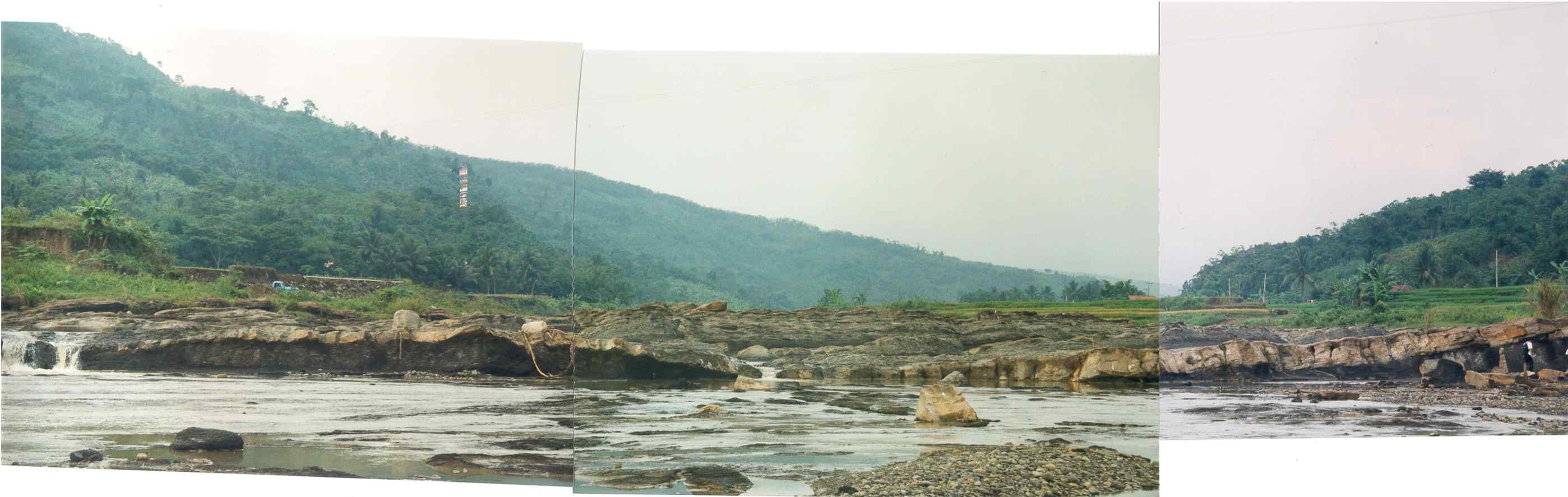
Panoramic photo of sharp-based shelfal sandstone at the Cipamingkis River.
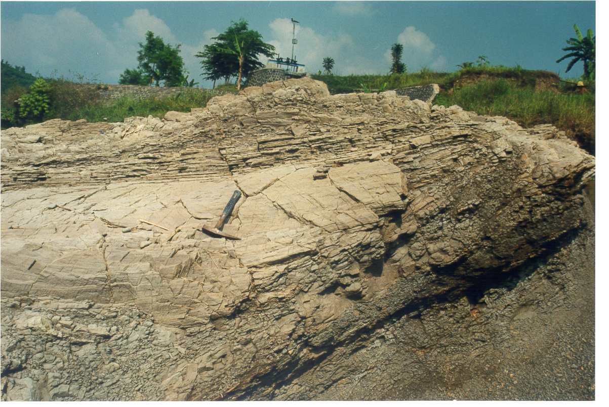
Slump structure at the Cipamingkis River.
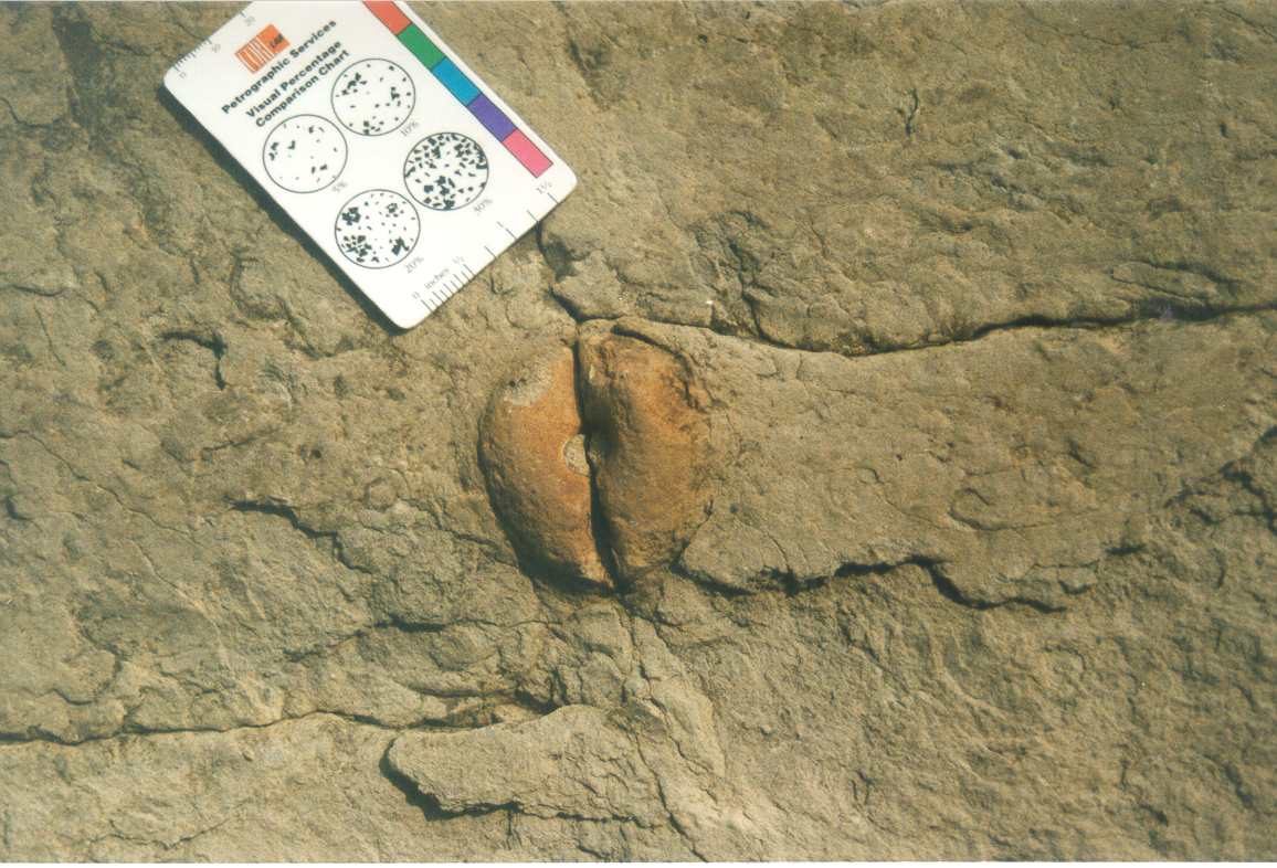
Burrow feature at the Cipamingkis River.