A blogpost version of FOSI foldouts series #1, compiled by H. Darman, F. H. Sidi, A. Wiweko, B. Lambert & B. Seto, 1999.
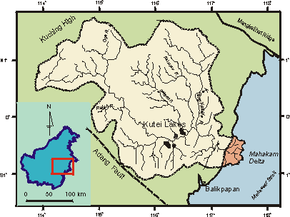
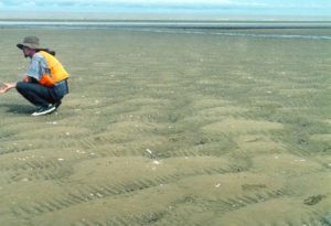
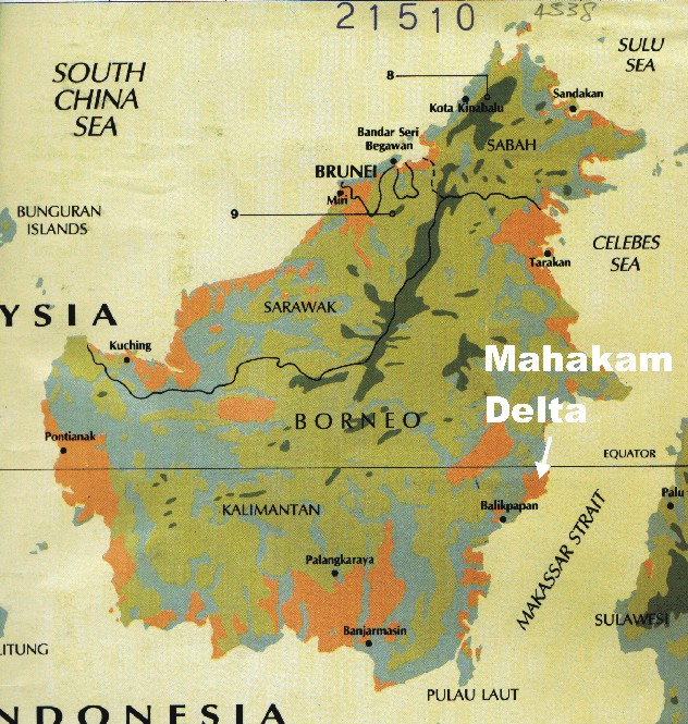
The Mahakam Delta, located on the east coast of Kalimantan, Indonesia, is an active delta system which has formed in humid tropical environment under condition of relatively high tides, low wave-energy, and large fluvial input. Tidal processes control the sediment distribution patterns in the deltamouth and are responsible for the flaring estuarine-type inlets and numerous tidal flats.
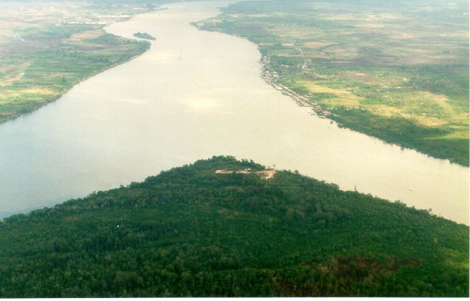
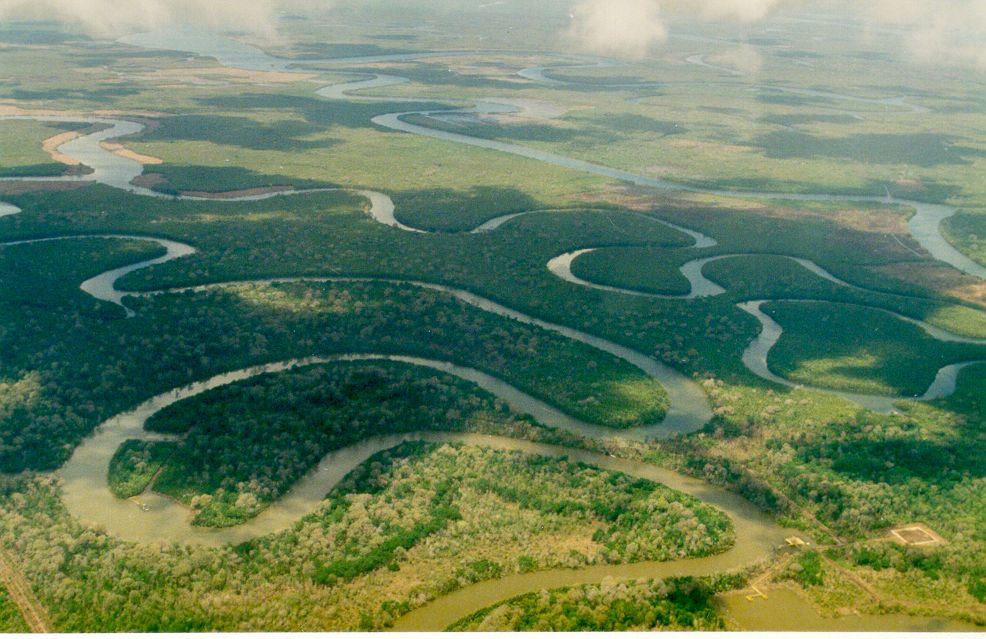
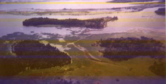
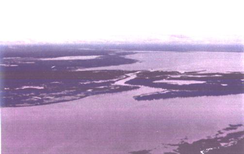
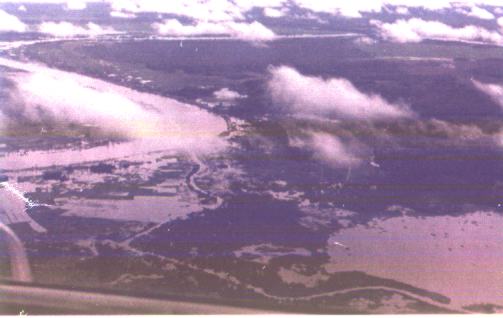
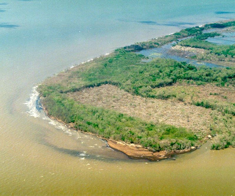
Mahakam Delta from the Air
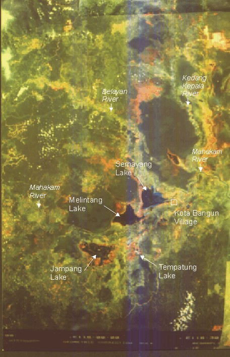
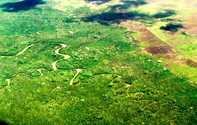
Mahakam Delta Morphology
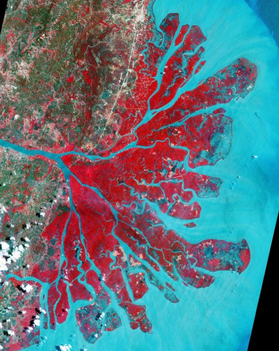
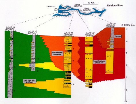
The Mahakam delta exhibits a symmetrical fan-shaped morphology typical of fluvial-dominated deltas accumulating in shallow water. The delta plain is densely vegetated and incised by fluvial distributaries and tidal channels. The fluvial distributaries are rectilinear and bifurcate seaward from the Mahakam river. They are groped into a northern system and a southern distributary system while the central part of the delta forms a tide-dominant interdistributary zone characterized by sinuous, esturarine-like tidal channels (Allen & Mercier, 1994)
The general morphology of the delta can be divided into three radially concentric systems: the delta plain, delta front, and prodelta.
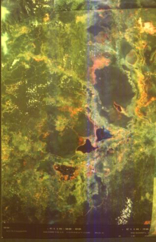
Mahakam Delta Facies Distribution
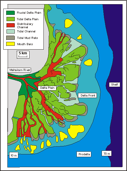
The modern Mahakam Delta can be divided into six facies units:
- Fluvial delta plain
- Tidal delta plain
- Distributary channel
- Tidal channel
- Tidal mud flats
- Mouth bar
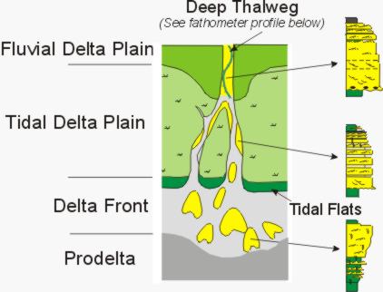
Fluvial Distributary Channel
- organic clay
- rippled sand-mud lamination
- cross bedded medium sand with carbonaceous laminae
Tidal Distributary Channel
- rippled sand-mud lamination with scattered burrows
- cross bedded and rippled fine to medium sand with mud laminae
Distributary Mouth Bar
- fine to medium bioturbated sand
- bioturbated mud with fine sand
- massive prodelta mud
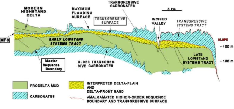
Stratigraphic interpretation of a high-resolution seismic dip section in the Mahakam delta (modified from Roberts and Sydow, 1996). The prograding clinoforms beneath the modern (highstand) delta represent the late Pleistocene lowstand delta that prograded to the edge of the shelf and was subsequently transgressed during the Holocene sea-level rise. The master sequence boundary in this instance is expressed as a correlative conformity located beneath the early lowstand delta, which, in turn, is overlain by an unconformity and incised distributary channels associated with higher frequency sequence boundaries punctuating the period of relative sea-level fall. The transgressive systems tract consists of carbonate shoals, onto which the prodelta muds of the modern highstand delta presently downlap.
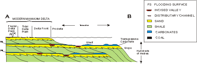
Schematic illustration of Pleistocene sequence stacking patterns (modified from Allen and Chambers, 1998) shows delta progradation was continuous during relative sea-level fall, so that the sand deposits of the highstand and early lowstand systems tracts are attached; an unconformity separates the early and late lowstand phases. The most obvious discontinuities in this type of sequence pattern are the maximum flooding surfaces and the unconformities between the early and late lowstand.
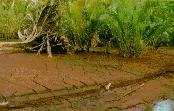
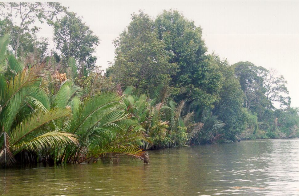
Vegetation
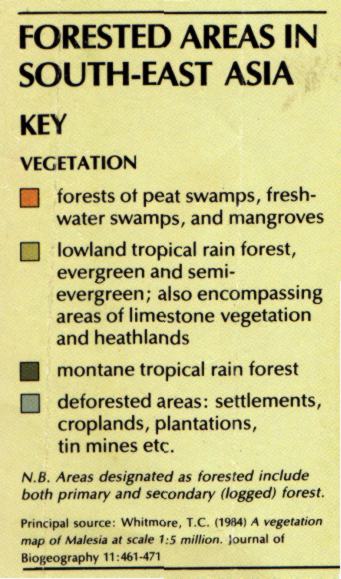
When you go to the modern delta system, along the rivers and river mouth, what you’ll see are mainly water and vegetations. Those are what recorded by the remote sensing images. As the natural vegetation is also dictated by a combination those factors which form the delta, we need to look at the vegetation as well.
People
Researcher, field trip leader, and other contributor to the science of the Mahakam Delta:
- George P. Allen
- Chuck Siemers
- John Chambers
- Andang Bachtiar
- Ateng Surachmat
- Agung Wiweko
- B. Giriansyah
- Angus Fergusson
Literature
Lambert, B., 2003. Micropalaeontological investigations in the modern Mahakam Delta, East Kalimantan (Indonesia). Notebooks on Geology, Article 2003/02.
Other Images